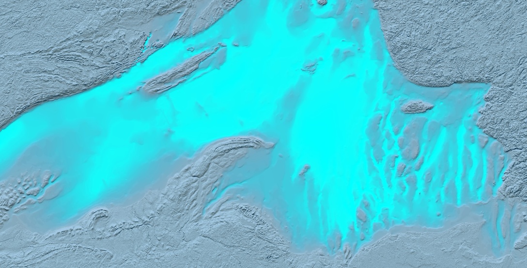
Here is the result of a late afternoon diversion. The bathymetric data comes from the NOAA Great Lakes Environmental Research Laboratory. The aspect ratio is consistent with a 1920×1080 monitor so it might make an alright desktop image, if you are into that sort of thing.
Quick process run-down, which will take as long to type as it was to do…
The digital elevation model renders by default along a grayscale ramp from black (low) to white (high) elevation -and in this case, bathymetry.

Then in ArcGIS Pro’s raster functions I ran a hillshade to produce a shaded relief layer. I gave it a high-contrast mud color since the lake floors tend to be pretty gentle.

Then I made a copy of the raw DEM and gave it a color ramp of nearly-transparent slate (shallow, where you can see the hillshade below) to opaque cyan (deep, low-visibilty).

Then with a second copy of the same DEM I set elevations above lake level to a tan color and elevations below lake level I set to transparent. A poor-mans layer mask.


Hi,
Are all the tutorials in Arcpro? I only have access to Arc map notthe pro version.
Thanks! Matt
On Wed, Dec 6, 2017 at 3:00 PM, Adventures In Mapping wrote:
> John posted: “Here is the result of a late afternoon diversion. The > bathymetric data comes from the NOAA Great Lakes Environmental Research > Laboratory. The aspect ratio is consistent with a 1920×1080 monitor so it > might make an alright desktop image, if you are into th” >
LikeLike
Hi Matt. Pro supports an opacity channel in color gradients, which is how this depth effect works.
LikeLike
Looks good! I really like the mask hack. I know the emphasis is on the bathymetry, but it seems like you lose some interesting detail by masking the hillshade on the ground around the lakes. Could be interesting to try modifying the mask to be semi-transparent to allow some of that to come through a little bit.
LikeLike
I totally agree! The nature of the DEM files,however, is that they just cover the bounding box of the lakes, so there are distracting gaps in land hillshade when the mask isn’t used.
If this were less of a late-afternoon map goof-off, I’d actually clip the lake DEMs and use a separate, full-coverage, hillshade behind them all.
LikeLike
Shoot, Jared, now you’ve got me adding in a secondary hillshade layer on top to stitch them together. Hang tight, this is going to look cool!
LikeLike
Well this is an amazing post and I have gathered a few points here
LikeLike
Thanks!
LikeLike