These days, every Friday night my family piles in front of the tv and we watch WandaVision. The weirdest show we’ve ever seen. And it just keeps getting cooler. And cooler. Most of the fun is in trying to decipher all the encoded clues and just nerd out with YouTubers who comb through each episode and speculate it to pieces. What a blast we’re having.
There is a pretty glorious bit of set dressing that a cartographic dork like me can’t help but notice. Command center monitors and touch screens all focus in on the hexagonal force field, home to the bonkers weirdness of this series. And I appreciate the fact that the set designers have oriented their hexagon the cool way,: points vertical. Professionals.
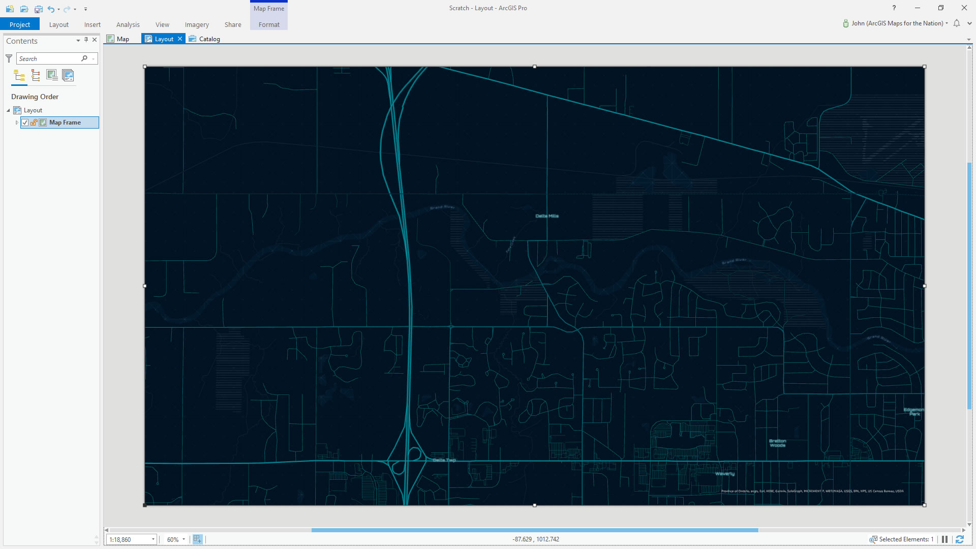
Naturally, nerds like us need to turn our neighborhood into a hexagonally cordoned force field of intense cinematic observation. Here’s sleepy Delta Mills in the grips of an Avengers-level threat:

Take This
Here is an image that you can overlay atop your own neighborhood map to immediately become the subject of fantastic scrutiny.
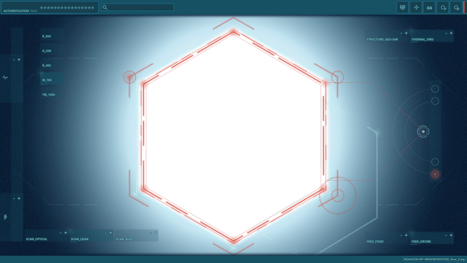
Right-click it, and save. Drape it over a map of your neighborhood. Have at it. Become the story.
If you have ArcGIS then you can just download this Pro project with the basemap and overlay all set up. Just choose your location.
Here’s how I set it up…
How To
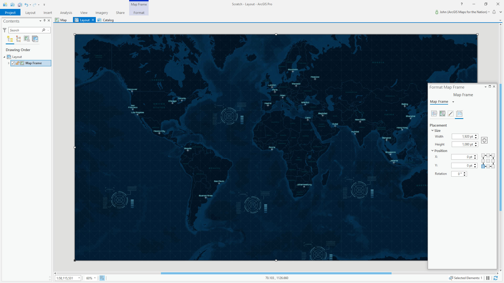
1 I added the cool spy-thriller Nova basemap.

2 I added a layout in the dimensions of my monitor (because I secretly want this to be my desktop image) and add the map frame.
3 Navigated (right-click, activate) to my neighborhood…
4 And inserted the image over the layout (insert, picture).
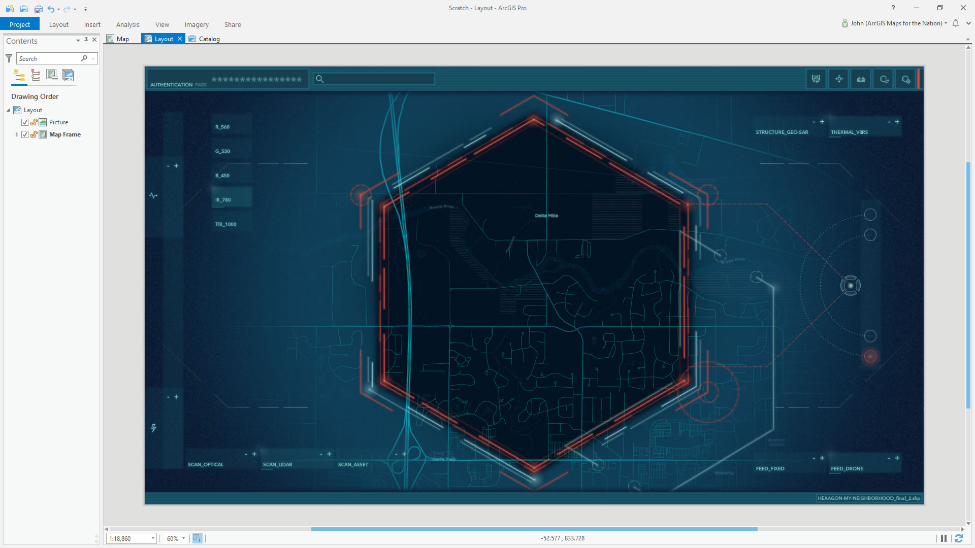
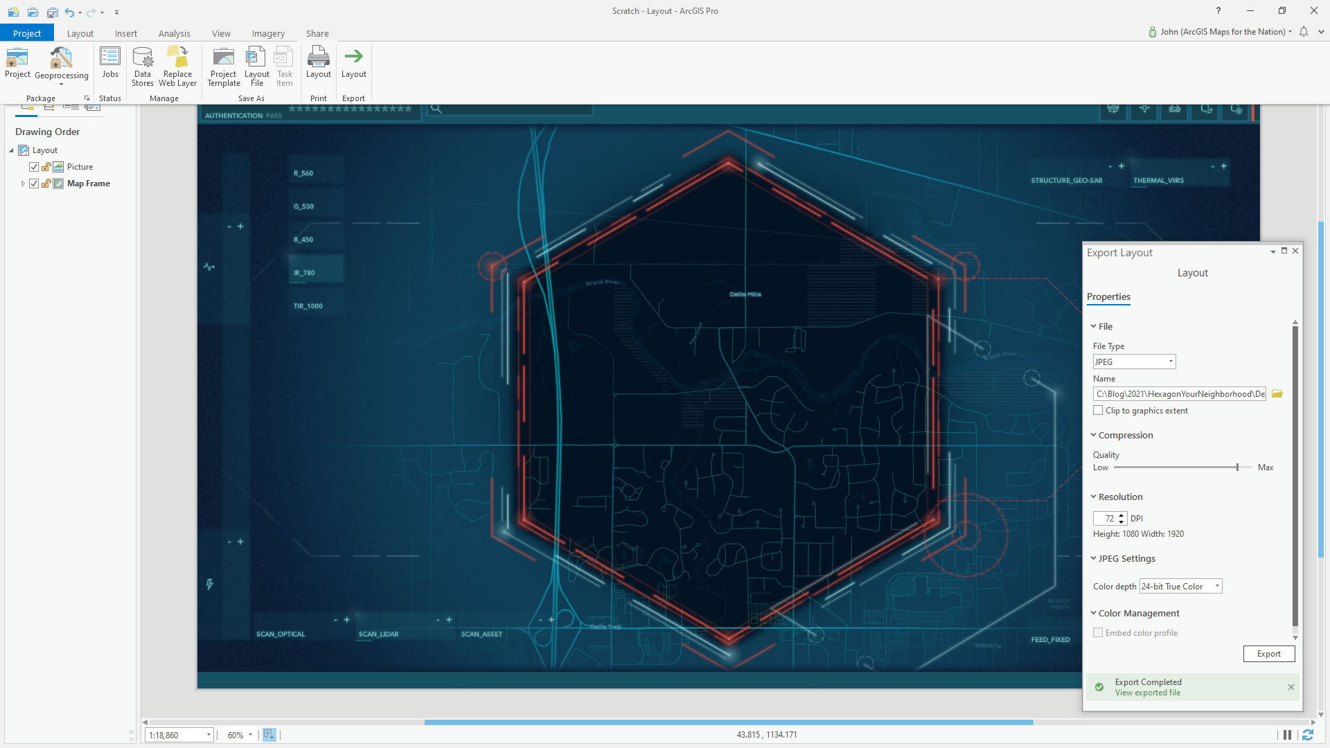
5 Then I just exported it as an image. 72dpi exports to the same pixel dimensions of the layout.
EXTRA CREDIT: I added in an imagery basemap and blended it with the Nova basemap using luminosity. Little more intense this way.

Stay safe out there. Love, John
Thanks to Javier Angel, who suggested this idea!