Here is a map of Germany’s forests and cities, in a watercolor style.

Here’s how to make it!
Landcover data comes from the Corine Land Cover Program, SRTM digital elevation model images, water and borders are available from the Living Atlas.
The styling comes from the Watercolor style for ArcGIS Pro.
I ran a query to isolate the forest and urban land cover types.

Then I ran a dissolve to merge all neighboring polygons of the same type together. I calculated their area and filtered out the smaller polygons.
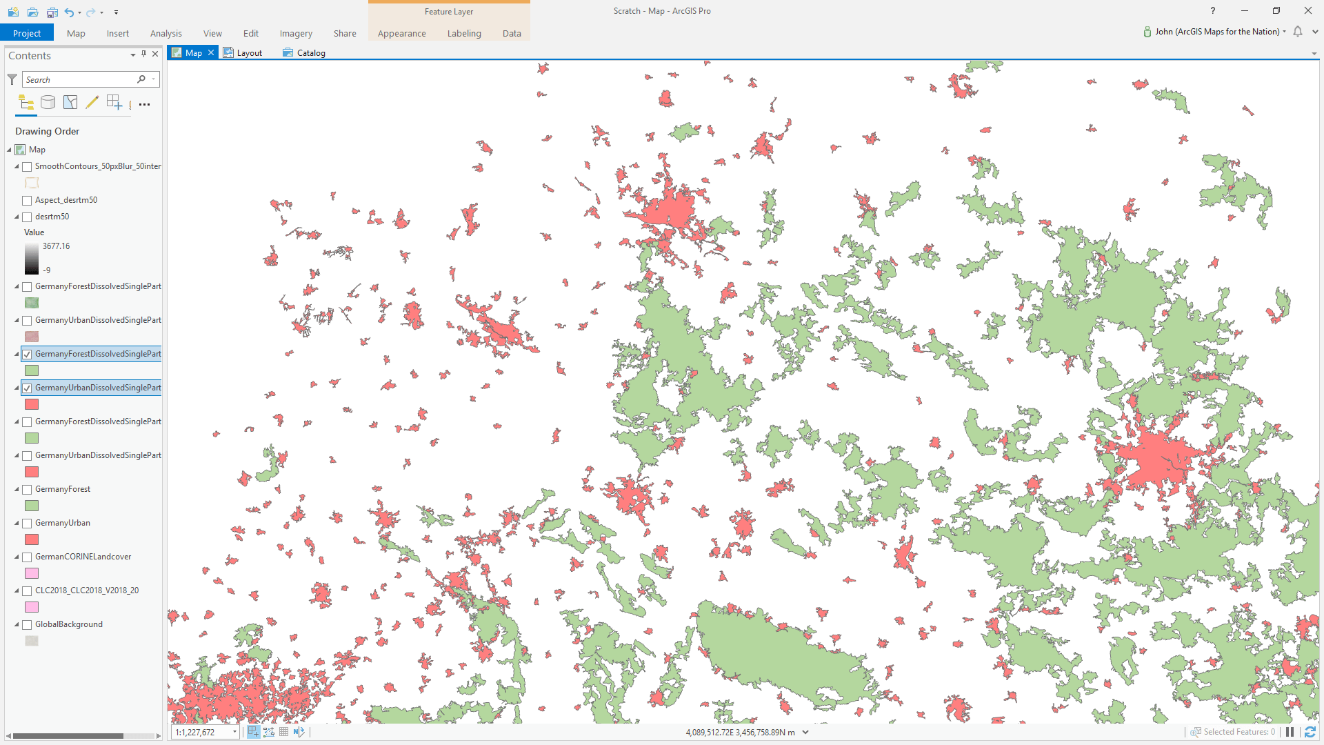
Using the Watercolor style, I gave the background a paper texture and the cities and forests their own painterly color.

With the digital elevation model images, I stitched them together so all of Germany was covered by a single DEM, I blurred it with a 20 pixel radius to generalize away the details, then I rendered an aspect layer from it (hills are color-coded by what direction they are facing). I gave the southeast-facing hillsides a very faint tan color.

Using the same blurry DEM, I created contour lines and gave them a pencil-y sketchy stroke symbol.

Then I played around with boundary strokes, water fills and coastal water lines, and applied the watercolor style to the title text. And that was that!

For a more detailed step-by-step, check out this blog post. Or grab the source Pro project and look under the hood.
Happy Mapping! John