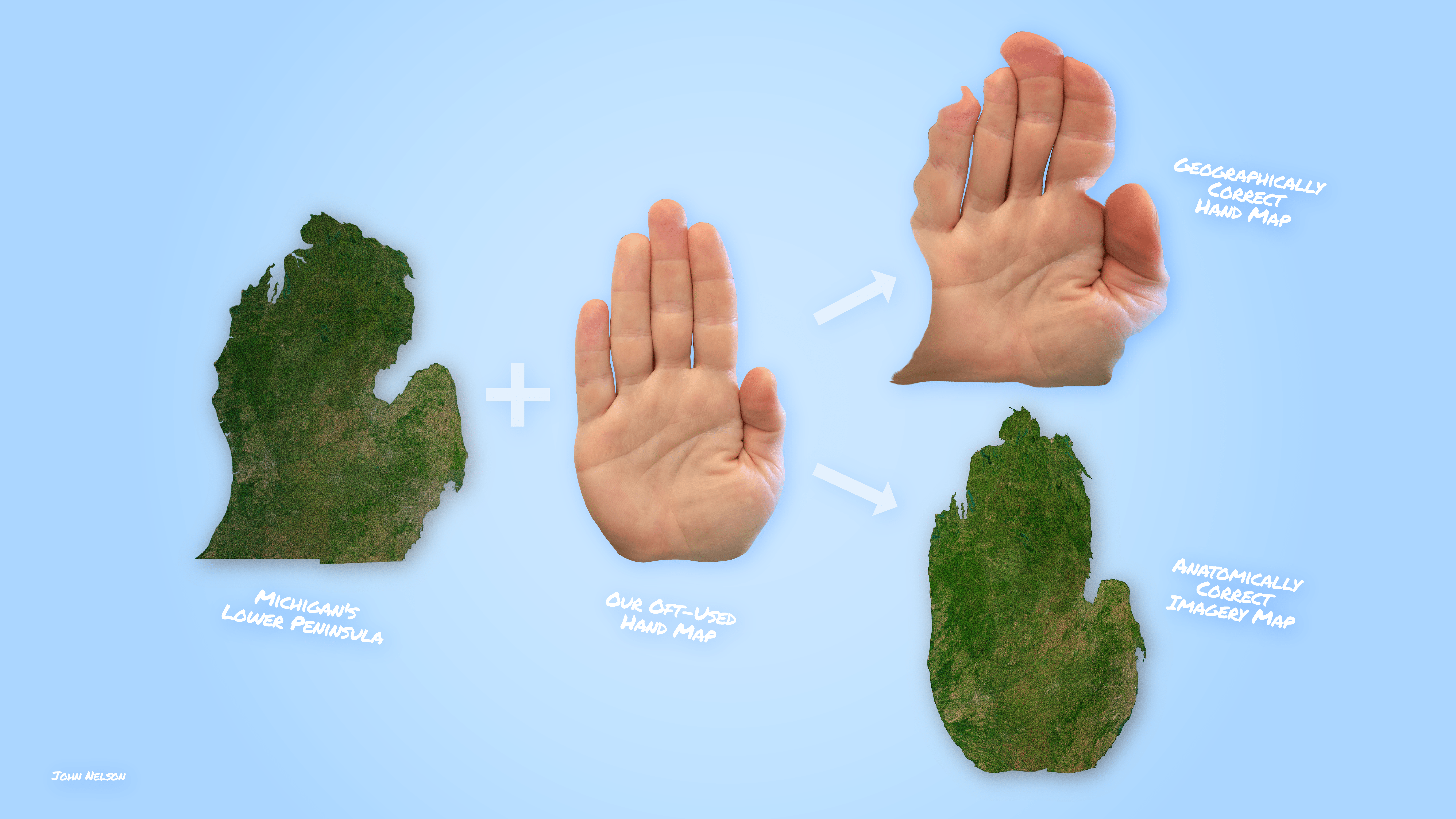
We in Michigan have been using our hand as the world’s most convenient cartographic resource since 1837. It gets a little gnarly when you include the Upper Peninsula, but that’s ok it still gets the job done.
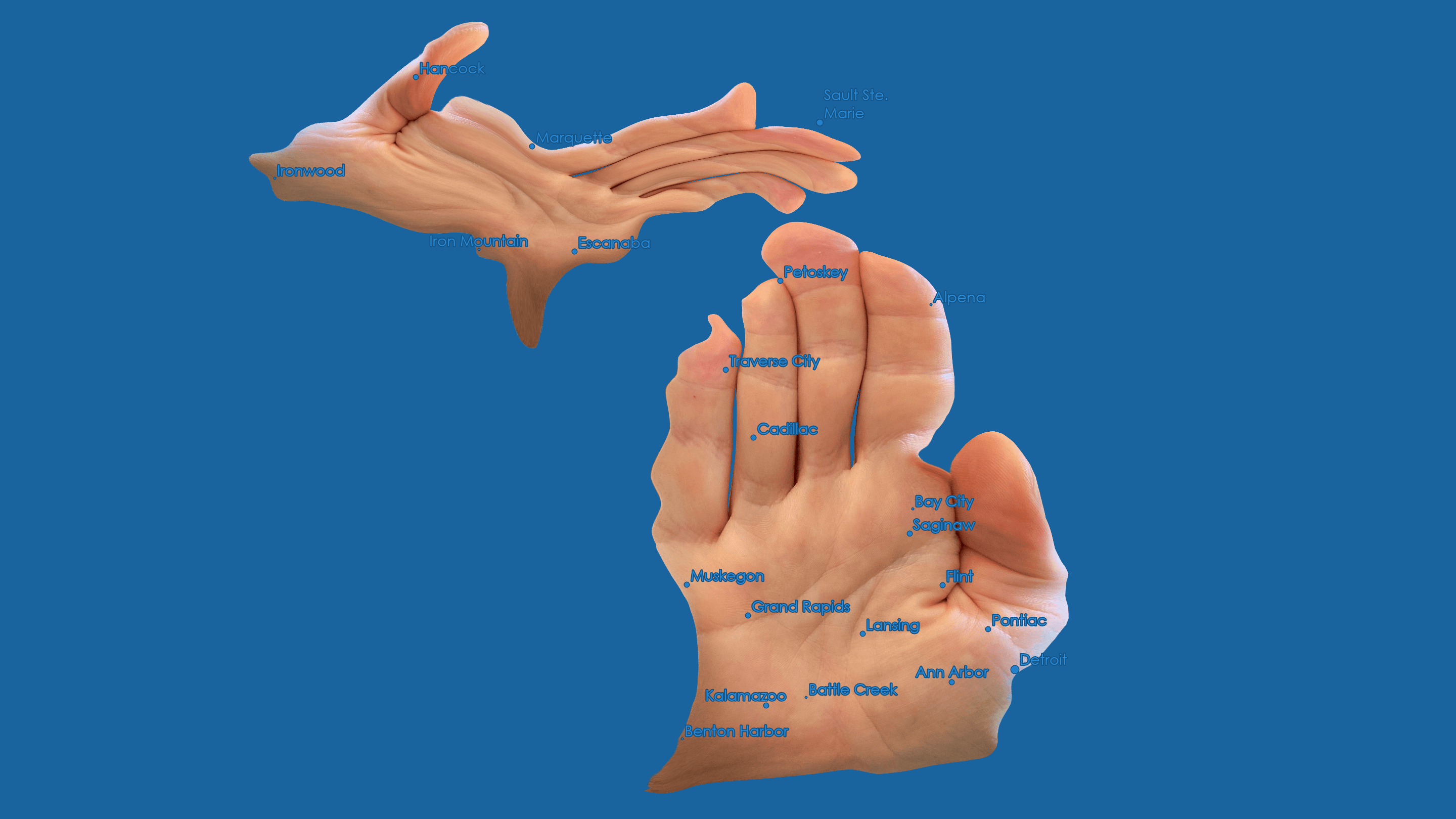
I’m an advocate of hand reference cartography for gesticulating your hometown to anyone remotely familiar with your state or country’s shape. You can use the hand map for just about any place. Just have to be careful with Idaho.
If you are feeling bold and want to give anatomically correct political border warping a go in world class GIS, here’s a guide:
Warning, you may find that some places slide into that uncanny valley between plausibility and abomination and may nestle themselves in your brain as nightmare fuel. Good luck.
Happy warping and pointing,
John (Michigander since 1978)