“I wisely started with a map, and made the story fit”
-JRR Tolkien
The map drawn by Christopher Tolkien for his father’s book is a simple and beautiful reference. Absorbed for hours by curious minds through several generations, traced by countless fingers over the decades, and soaked up by a host of imaginations—mine included—where it has become the gold standard of fantasy mapping. Here’s how you can assemble your own fantasy-style map, with real geographic data, inspired by this seminal Lord of the Rings cartography.
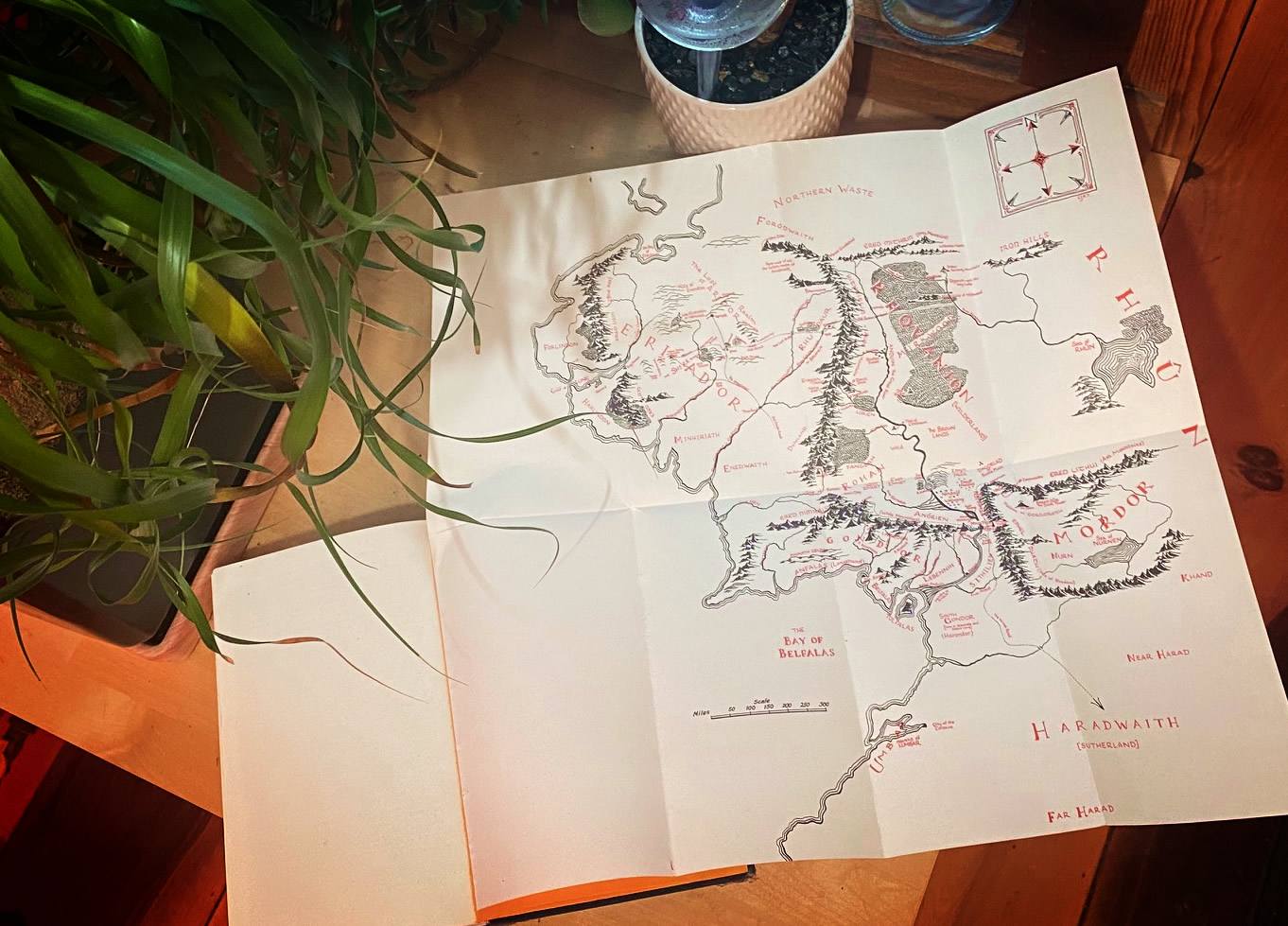
In this 4-part series we’ll walk through the reckoning of a Lord of the Rings style fantasy map, right in ArcGIS Pro. We map-makers get to breathe honest to goodness geographic life into the seminal aesthetic found in the LOTR cartography, and I think that’s a bit of magic just waiting around for us to wield.
If you’d rather just jump in to the making, you can find the “One Style to Rule Them All” style for ArcGIS Pro here: esriurl.com/nelsonstyles
…
Part 1: How to grow a forest
0:00 Pretty stunning intro
1:03 Deconstructing the forest components
1:27 Planting a forest perimeter
2:36 Filling in the forest with a repeating pattern
3:42 Those cute little tree trunks
5:01 Giving this map a paper texture
5:42 Personalizing with some shading and tinting
10:15 Save symbol to a re-usable style
…
Part 2: How to move mountains
0:00 Eye-wateringly dramatic intro
0:14 Examining mountains in Tolkien’s map
0:45 Photoshopping a mountain image asset
1:12 Wes Jones’ fantasy mapping channel
1:30 Add a mountain marker layer
2:36 Highlights
3:08 Add a foothill marker layer
4:28 Saving mountain symbol to a style
…
Part 3: How to fill the seas
0:00 Rapturous into
0:16 Tolkien’s water reference
0:50 Review of the previous symbols
1:16 Wavy scratchy rivers
2:56 Water tint
3:54 Coastal rake
5:38 Water line ripple ring things
6:54 Dark water!
7:33 Oceans
…
Part 4: Putting it all together
0:00 First, a reading
0:21 Where to find this style resource
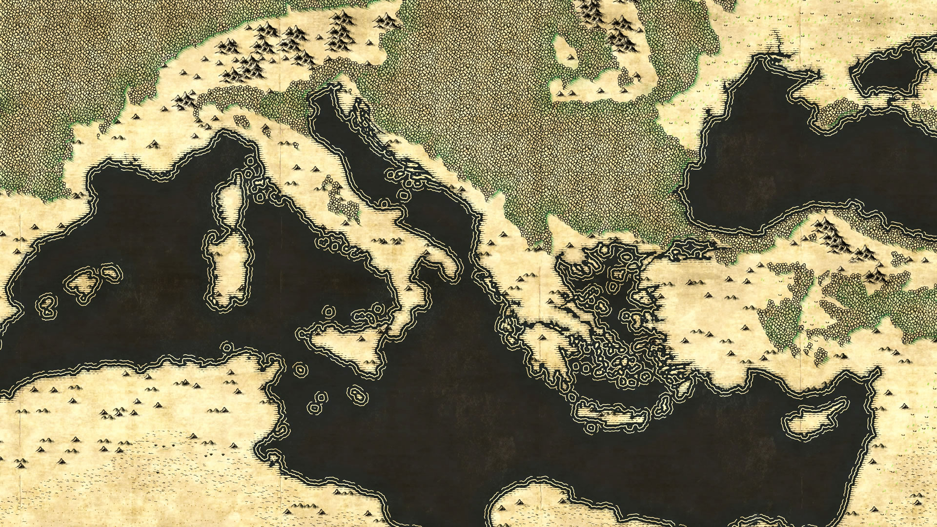
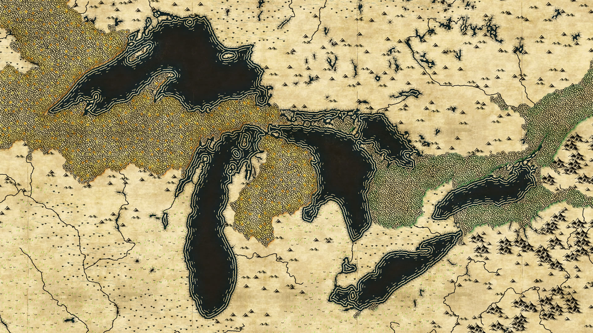
0:36 Data sources (Natural Earth water features and Living Atlas Ecoregions)
0:54 How to add a style to a project
2:05 Adding a Living Atlas paper texture
2:45 Planting ecoregions in (Middle) Earth
3:18 Some examples
…
Thanks for following along on this unexpected journey! I’d love to see the fantastic maps you make and hope you’ll share them with the community for fun and encouragement. Here are some of mine…


Happy mapping! Love, John

Very much interested!
LikeLike
I love maps!!!Thank you for creating this amazing blog.
LikeLiked by 1 person
i would certainly be interested! 🙂
LikeLike
So yes! Both can’t wait for the style files and also would prefer to get my teaching finished for the year first…
LikeLike
You, sir, are the Devil.
Or genius; I can’t decide yet.
Thank you, great work!
LikeLiked by 1 person
Any QGIS port… ?
LikeLike
You can use the images I link to to build your own map/style in your system of choice.
LikeLike
Do you have a license for these? Are they public domain? Or cc by? https://creativecommons.org/licenses/by/4.0/
LikeLike
You can just use them.
LikeLike
What font are you using for the writing?
LikeLike
Aniron by Pete Klassen.
LikeLike
there’s still a noticeable pattern of repetition in the forests and mountains which defies the purpose imho. might be interesting to aim for something like an algorithm that actually draws this stuff like a human would, with all the doubts along the way 😉
LikeLiked by 1 person
Options to use this in ArcGIS Online?
LikeLike
I made it in Pro, but it wouldn’t be hard to tile up for AGO.
LikeLike
This blog is amazing! Both the content and the minimal design.
LikeLike
It’s “poring” not “pouring”.
LikeLike
Holy crap, I never knew that! thanks.
LikeLike
Hi there,
I submitted this post to Hacker News, and lots of people loved reading it! There were a few people that might go off and make an Open Street Map tileserver with these wonderful graphics.
Anyway link if you’re interested -> https://news.ycombinator.com/item?id=17963159
LikeLike
Yes thanks Patrick! To export these as basemap tiles would be super simple.
LikeLike
You just went from John Nelson the Grey, to John Nelson the White. Thanks for all the amazing blog posts. Your work is inspiring.
LikeLike
Ha! Thanks Aaron. I didn’t even have to smite a Balrog’s ruin on a mountain to get there.
LikeLike
How do you get the orange titles to appear since they are designated as “areas”
LikeLike
they are area labels.
LikeLike
John would it in anyway be possible to use these map textures (trees, mountains, etc.) in Photoshop as I don’t have ArcGIS.
LikeLike
Hi Gilon! Well they are collections of graphics I’ve drawn and ArcGIS sprinkles them into the appropriate areas. Here are some beautiful brush resources I’ve found via The Cartographers’ Guild that you might find helpful. https://www.deviantart.com/starraven/art/Sketchy-Cartography-Brushes-198264358
LikeLike
I think I’m confused about how you made these maps. Did you essentially make the ArcGIS equivalent of Photoshop brushes or is there some sort of translation that ArcGIS Pro is doing to place the representations of rivers, mountains, etc for you?
LikeLike
It’s a combination of both of these I suppose. Specifically, I am using an ArcGIS Pro “style”. A style is a collection of symbol resources that you can apply to your data. Here are a collection of styles I’ve made: https://www.esriurl.com/nelsonstyles
Regarding how Pro knows were to draw the specific landcover graphics, the underlying vector data is a set of polygons delineating global landform types. I’ve just created a thematic map linking the landform type attribute to the style fill that it best matches.
Hope this helps!
LikeLike
I think I got it. Just having trouble getting ArcGIS to apply the style to the map. Maybe I need to download those other maps you were using in your Americas? I’m quite new to all of this.
LikeLike
In Pro’s symbology window (if you’ve added the style to the project) there is a Gallery tab. Choose that to see the Felt style and apply them to your features.
LikeLike
How do I run this program? It asked me what to use, and I tried all of the options (like Word, InternetExplorer, Paint, and more) but none of which worked.
LikeLike
This is a style file resource for ArcGIS Pro, a mapping tool.
LikeLike
You are a hero to me for posting and sharing your assets!
LikeLike